The use of Geographic Information Systems (GIS) to model the array of data obtained for, and during, a seismic survey is now an essential requirement of any survey. Data from the mineral and surface leasing departments, hazard data from survey, data on the terrain can be modeled and adjustments to the survey grid can be made before the seismic crew is in the field. This leads to a more cost effective survey, improved data quality (as on the fly source offsets are all but eliminated) and happier land owners.
Using industry standard software as the platform KESI has produced an interactive GIS database system. The database is maintained from the survey inception until completion and beyond.
|
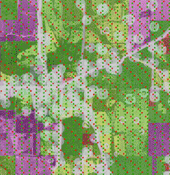
Typical GIS layers are shown here > |
 |
|
|
Survey Pre-Plot Hazard Buffers Surface Conditions Surface Parcels Topographic Map Aerial Photo Elevation Model Combined |
||
This methodology is not restricted to the acquisition of seismic
data there are many other applications where this system of data
integration can and has been employed.